

Inhalable Particulate Matter PM10 and PM2.5 Detection
Particulate Matter (PM) is everything in the air that is not a gas and as such, it is made up of a wide variety of chemical compounds and materials some of which can be toxic.
Drone Site Surveys offer real time air pollutant mapping using drones.
Our system is able to monitor multiple air pollutants in real-time allowing the timely identification of pollutant sources and transport routes.
Harnessing the benefits of aerial data capture allows large areas to be scanned quickly and sufficient amounts of data to be captured for comprehensive analysis of the air quality at the location. The spatial distribution of detected particles and pollutants can be visually represented in a 2D map and 3D model of the area clearly showing concentration levels across the entire area at different elevations.
The data collected can be used for environmental monitoring, gas leak detection, emission releases, and chemical release monitoring.

Map Your Environment with an Air Survey
What are PM10 and PM2.5
Airborne particulate matter (PM) is a mixture of many chemicals and compounds. Particles vary widely in size, shape, and chemical composition, and may contain inorganic ions, metallic compounds, elemental carbon, organic compounds, and compounds from the earth’s crust. Particles are defined by their diameter for air quality index purposes. Those with a diameter of 10 microns or less (PM10) are inhalable into the lungs and can induce adverse health effects. Fine particulate matter is defined as particles that are 2.5 microns or less in diameter (PM2.5).
We collect air and gas pollution data and deliver it as intuitive and actionable information. Using the HSE’s workbook, EH40/2005 you can easily compare the list of workplace exposure limits for use with the Control of Substances Hazardous to Health Regulations 2002.
Find out more about the workplace exposure limits of these substances.
The collected data visualisations can be delivered in 2D Grid, 2D contour, and 3D point cloud air pollution distribution maps.
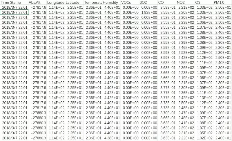
The raw data is delivered by CSV file which can then be easily exported into programs like Matlab, R and MS Excel for further analysis.
Collecting Air Pollution & Gas Detection Data
The data can be collected using drones, vehicles, or wearables.
Drones are efficient at collecting data by scanning large areas in short periods of time. Following all local drone laws, you can capture huge sites, towns and cities in just a matter of hours.
With our innovative bracketry, vehicles can be turned into air pollution detection vehicles for areas, like city and town centres, where drone flying can be impractical.
We can also supply wearable sensors that free up the operative’s hands when approaching potentially dangerous environmental sites.
Vapour Sampling Survey
As well as digital monitoring, we can also collect physical samples of air or gas pollution using attachments that are connected to our drones.
The sample bags are connected to the drone and start to collect gases when switched on in our digital app. This allows us to safely fly over target areas to collect the samples. The samples stop collecting automatically when full.


How Clean is the Air? Find out with Drones
UK Gov Monitoring Air Pollutants PM10 & PM2.5
The UK Government is monitoring air particulate emissions trends and has statistics showing a huge decrease since the 1970s. As a nation we can still do better as people who are affected are generally the young and old, asthmatics, and others with respiratory diseases such as COPD. You can read more from the UK Government at the link here.
The World Health Organisation also states that PM2.5 is associated with the greatest proportion of adverse health effects related to air pollution worldwide based on the WHO’s Global Burden of Disease Project.
Air Quality Monitoring and Assessment
We use the latest technology to detect not only the gases but also some heavier particles in the air that contribute to the air quality assessment. We can identify substances that can cause a variety of medical conditions. Conditions such as occupational asthma, asphyxiants, pesticides, carcinogenic and mutagenic substances, fume, dust, subtilisin, ferrous foundry particulate, halogeno-platinum compounds, machine-made mineral fibres (MMMF), and pulverised fuel ash.
What Gases and Air Pollutants can you Detect with a Drone?
Our system can detect up to 9 gases and air pollutants in one flight.
The Gas Detection unit can search for among others
- Ozone (03)
- Nitrogen Dioxide (NO2)
- Cobalt (CO)
- Sulphur Dioxide (SO2)
- Hydrogen Sulphide (H2S)
- Carbon Dioxide (CO2)
- Ammonia (NH3)
- Methane (CH4)
- Hydrogen Chloride(HCI)
- Phosphane(PH3)
- Hafnium (HF)
- Oxygen (O2)
- Hydrogen (H2)
If you would like to know more about our air pollution and methane/gas inspections, then please don’t hesitate to contact one of our aerial data collection experts.
Check your Environment with a Drone Inspection