Understand every aspect of your land with a range of topographical surveys. We can provide DSM, DTM and DEMs of your land to give you a snapshot of your ground.
Find out More Here
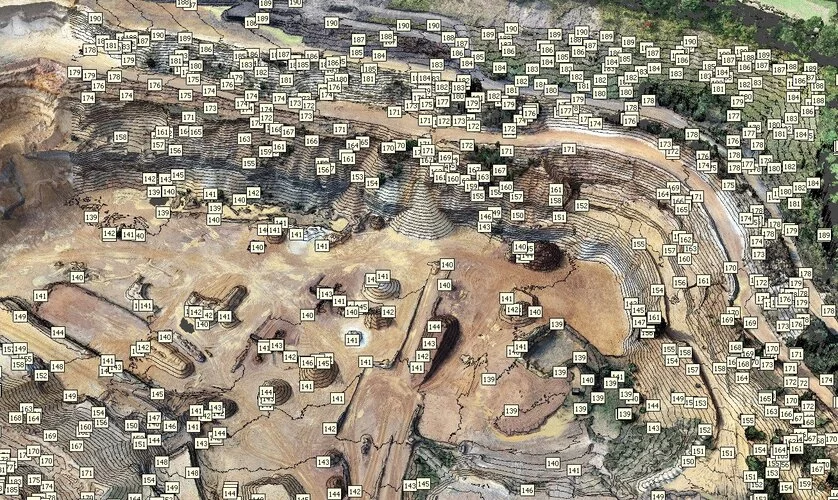
Topographic Survey
A topographical survey or topo survey will provide you with an extremely accurate depiction of your land. Using drones, we can scan a large area to provide you with relative height details of anything inside that defined area. By analysing everything from trees, buildings, land and any other structures, you can gain an extremely accurate snapshot of your land.
Topo surveys with drones will help you achieve results faster and cheaper than any traditional methods. Contact us today to discuss your survey needs and get booked in.
Our drone topo surveys can produce a variety of different data for you. Everything from 3D Point clouds, to surface models with a variety of different data points on for your topo measurement.
On top of our flexible surveys, we can also provide the data to you in a mutlitude of different file formats. If you have a piece of software to aim for, then we will provide you files specific for that programme.
Different Topo Surveys We Provide
Although a topo survey is a relative height measurement, it still comes in a number of formats. When processing the data we can supply you with any of the following.
DEM – Digital Elevation Models
DSM – Digital Turface Models
DTM – Digital Terrain Models
Point Clouds
Any other requirements you may have (call to discuss)
Let us provide you with the best surveys available using drones. We are drones for construction specialists so expert advice is always on hand to help you with your intended outcome of the survey. Simply drop us a line and find out how to get started.