

Drone Building Surveys - Scaffold-Free Roof & Façade Inspections
See every roof, gutter, chimney and façade in high resolution, without erecting a single scaffold tube. Our drone building survey, depending on your requirements, can capture 4K imagery, thermal data and measurable 3D models of your building’s external envelope in a single site visit. Results are delivered through a secure online portal so that you can make repair and maintenance decisions days sooner and at a fraction of the cost of traditional access.
Request a Free Quote · Call 0345 017 5592 · We usually respond within 2 business hours
✔ CAA Operational Authorisation 11363 · ✔ £10M Public Liability · ✔ Constructionline Gold · ✔ BINDT Level 2 Thermographer · ✔ Safe Contractor · ✔ SSIP · ✔ Nebosh · ✔ Cyber Essentials
Not Sure What Survey You Need? Talk to Our Team
What is a Drone Building Survey?
A drone building survey is a planned, high-level visual and data inspection of a building’s external fabric, carried out by a CAA-authorised pilot using an unmanned aerial vehicle (UAV).
Instead of placing a person at height, the drone flies a controlled pattern around the structure and captures overview and close-range imagery of all elements, even those that are difficult, costly or dangerous to reach.
A typical survey covers:
- Roof coverings – slates, tiles, flat roof membranes, metal and profiled sheet roofs, rooflights
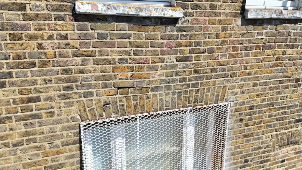
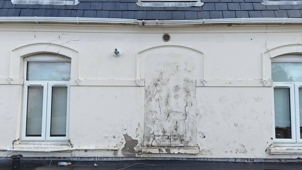
- Façades and elevations – brickwork, render, cladding panels, pointing, lintels and window surrounds
- Chimneys and stacks – flashings, flaunching, pots, leaning or cracked stacks
- Rainwater goods – gutters, outlets, downpipes, fascias and soffits
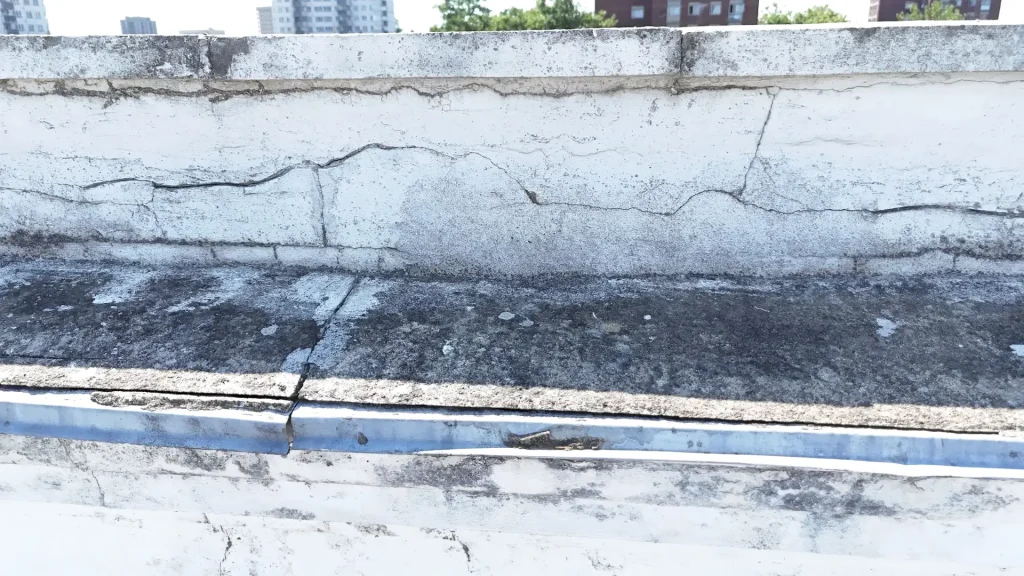
- High-level structural elements – parapets, copings, dormers, gable ends, plant enclosures and roof-mounted equipment
Depending on the brief, the survey can be purely visual (a UAV building condition survey), thermal, measured, or a combination.
Every image is referenced to its location on the building using coloured sectioned overviews, so a surveyor reviewing the data back at the office knows exactly which elevation and bay they are looking at.
It’s important to be clear on scope: a drone survey records what is visible externally.
It supports, rather than replaces, the professional judgement of a chartered surveyor, and where a written assessment is needed, we offer optional condition reports prepared by our qualified roofing surveyors.
Send Us Your Site Details
Who Uses Commercial Drone Building Inspections?
Since 2019, we have surveyed over 2,117 roofs and recorded 19,738 faults and growing, for clients including Rider Levett Bucknall, AECOM, Ridge and Partners, Watts Group, Liverpool City Council, the NHS and Co-op, to name but a few. Our client base includes Chartered Surveyors, Facilities Managers, Construction Companies, Housing Associations, Heritage Sites, Retail Chains, Care Homes, Local Councils and domestic clients.
Commercial Offices and Mixed-Use Buildings
Multi-storey offices often sit on busy streets where scaffolding means licences, pavement closures and weeks of lead time. A drone survey captures roofs, parapets and curtain walling with minimal disruption to tenants or the public.
Industrial Units and Warehouses
Large-span roofs with fragile rooflights and asbestos cement sheeting are high-risk to walk. Drones inspect the full roof area safely, and thermal imaging can help pinpoint likely water ingress beneath flat and profiled roofs.
Housing Associations and Residential Blocks
Asset managers use drone surveys to gather consistent, comparable data across whole portfolios for stock condition surveys, planned maintenance programmes and damp and mould investigations. Occupied blocks can be surveyed without residents’ daily lives being disrupted.
Historic, Listed and Heritage Buildings
Churches, listed buildings and heritage assets frequently have fragile roofs, ornate stonework and restrictions on fixing access equipment. A drone inspection is entirely non-contact, making it ideal for recording condition without risking damage to historic fabric.
Dilapidations and Schedules of Condition
For landlords, tenants and their surveyors, time-stamped, high-resolution imagery provides an objective record of a building’s condition at lease start, lease end or before neighbouring works begin. See our schedule of condition surveys.
Drone Surveys vs Scaffolding and MEWPs
For most external inspections, the drone is airborne, and the data is captured before scaffold quotes have even come back.
| Drone Building Survey | Scaffolding / MEWPs / Cherry Pickers | |
| Speed | Typically completed in a single site visit | Days or weeks to quote, erect, inspect and strike |
| Safety | No operative required to be working at height | Working at height is required, with the associated risk |
| Cost | No access hire, road permits or licences other than our CAA licensing | Hire, erection, licences, traffic management and possible lane closures |
| Disruption | Minimal – no structures left on site | Scaffold on site for the duration; possible security risk |
| Coverage | Whole roof and every elevation, including areas hidden from ground level | Can be limited by where the platform or scaffold can reach without costly structures |
| Data | 4K stills, video, thermal imaging, orthomosaics, point clouds and 3D models | Handheld photos and notes |
| Repeatability | Easy to re-fly and compare condition over time | Access needs to be re-established each time |
Safety First
Falls from height remain one of the leading causes of serious workplace injury in UK construction. Removing the need for anyone to climb onto a roof or façade is the single biggest benefit of drone surveying. It also helps clients meet their duty under the Work at Height Regulations 2005 to avoid work at height where reasonably practicable.
Where do Drone Site Surveys Operate?
From our headquarters in Liverpool, Drone Site Surveys provides nationwide coverage across mainland Britain. Alongside our core team, we have a network of strategically located pilots throughout England, Scotland and Wales. Every pilot is trained to follow our standardised capture procedures, ensuring you receive consistent, high-quality imagery, data and deliverables across every site – regardless of location.
This nationwide capability allows us to efficiently support individual surveys, multi-site projects and large property portfolios throughout the UK.
Lower Cost, Faster Decisions
Without scaffolding, the main costs of a high-level inspection disappear. Faster data also means defects are found and repaired earlier, before a small slipped slate becomes an internal leak and an emergency call-out.
Higher Resolution Than the Naked Eye
Close-range 4K imagery lets a surveyor zoom into cracked pointing, split flashings and blocked outlets from a desk. Thermal cameras reveal patterns invisible in normal photographs, while photogrammetry aligned with Ground Control Points turns thousands of images into a measurable 3D model.
Send Us Your Property Details
Our Drone Building Survey Process
1. Brief, Feasibility and Permissions
We review your address, scope and required outputs, then check airspace, site constraints and any permissions needed. Thanks to our CAA Operational Authorisation, we are typically cleared to fly without further approvals, and to date we have never been denied permission to carry out a roof inspection anywhere in the UK.
2. Risk Assessment and Method Statement (RAMS)
Before every flight, you receive pre-flight documentation, including site-specific RAMS, so your H&S team and building occupants know exactly how the inspection will be carried out.
3. On-Site Data Capture
Our pilot selects the right aircraft from our squadron of drones for the job, whether that’s close-range visual inspection, thermal capture or mapping for 3D models. Our pilots are trained not to make assumptions but to capture every visible detail, so nothing is missed.
4. Processing and Analysis
Imagery is organised by elevation using coloured sectioned overviews. Where specified, photogrammetry data is processed into point clouds and 3D models, and thermal data is captured and reviewed by our BINDT Level 2 thermographer.
5. Report and Data Delivery
All images, video, models and reports are delivered through our secure, password-protected online portal, ready to view immediately and download at your convenience. Optional written condition reports can also be added, along with measured CAD drawings.
Deliverables and Survey Technology
Every drone building survey is scoped to what you need, from a quick visual check to a full measured and thermal survey. Discuss your requirements before each flight so that we ensure you get the correct deliverables
- High-resolution 4K stills – close-range imagery of every roof slope and elevation
- Coloured sectioned overviews – so every image is located on the building at a glance
- Thermal imaging – highlighting heat loss, missing insulation, thermal bridging and possible moisture under flat roofs (see thermal surveys)
- Georeferenced orthomosaics – scaled, measurable plan images of roofs and sites
- Point clouds and 3D models – with ground control points, viewable in our custom-built model viewer where you can measure distances, areas and angles and extract coordinates (see point cloud creation)
- 2D elevation drawings (DWG) – produced from façade point clouds for design teams if specified
- Written condition reports (optional) – prepared by our qualified roofing surveyors, highlighting defects and priorities
- Secure portal access – all data in one place for your team, contractors and clients
Inspect More Without Scaffolding
Frequently Asked Questions
How much does a drone building survey cost in the UK?
The cost of a drone building survey depends on the size and height of the building, the number of elevations, site constraints (such as airspace or busy public areas) and the deliverables you need. A visual roof survey costs considerably less than a full measured and thermal survey with a written report. In almost every case, it is significantly cheaper than scaffolding or MEWP hire, which adds erection, licences and traffic management. For image-only surveys, Domestic Properties start at £250.00+VAT, and Commercials start at £350.00+VAT. Send us the address and your brief for a fixed quote, usually within 2 hours.
Can drones detect water leaks or thermal defects in buildings?
Yes, within limits. A thermal drone survey can show temperature patterns that indicate moisture trapped beneath flat roof membranes, missing or damaged insulation, heat loss and thermal bridging. Results depend on weather and timing, as a clear temperature difference is needed, so we plan thermal flights around suitable conditions. Thermal imaging identifies probable problem areas as a first port of call, and findings are best confirmed with targeted intrusive checks such as moisture readings or core samples.
Do I need council or CAA permission for a drone survey?
You don’t usually need planning or council permission for a drone survey. The legal responsibility sits with the drone operator, who must comply with Civil Aviation Authority (CAA) rules. We hold a CAA Operational Authorisation (No. 11363), which allows us to carry out commercial flights close to buildings and people under an approved operations manual. We check airspace restrictions, such as airport flight restriction zones, and arrange any additional permissions, plus landowner consent for take-off and landing, as part of every job. Read more on UK drone laws.
How long does a drone building survey take?
Most individual buildings are captured in a single site visit, often within a few hours, depending on size and complexity. Imagery is then uploaded to our secure portal, with processed outputs such as 3D models and written reports following afterwards. All images are guaranteed to be delivered within 48 hours of flight completion. Building Condition Reports, 3D and Revit Models, CAD drawings, Topos and any other deliverables will take longer to deliver. This will all be agreed before any onsite image or data capture.
Can a drone survey replace a chartered surveyor's inspection?
A drone survey is a data-capture tool that gives chartered surveyors, building surveyors and asset managers safe, detailed access to parts of a building they couldn’t otherwise see. Many surveying practices commission us to provide the high-level imagery that informs their own reports. Where you need a written assessment, our qualified roofing surveyors can provide an optional condition report.
Start Your Project With DSS