When you are making decisions worth millions, “good enough” data is never enough. Drone Site Surveys provides land developers with high-resolution aerial images and accurate data transformed into decision-ready outputs…

When you are making decisions worth millions, “good enough” data is never enough. Drone Site Surveys provides land developers with high-resolution aerial images and accurate data transformed into decision-ready outputs…
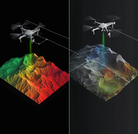
In aerial surveying, professionals often compare photogrammetry with LiDAR (Light Detection and Ranging). Both methods can produce accurate and reliable data, but how do they differ for external envelope building…

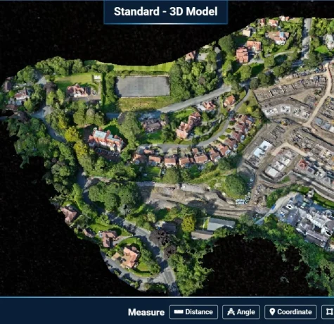
A topographical survey is a detailed survey that maps the physical features of a piece of land. This type of survey is commonly used in construction, engineering, and land development…


