
If you look after rail assets or telecoms masts, you already know the uncomfortable truth about “close enough”. A few millimetres can decide whether a component fits, whether a clearance is compliant, or whether an engineer needs another site visit. The issue is rarely the model itself. It is the confidence behind the numbers, the audit trail that proves them, and the ability to repeat the measurement next quarter and see a real trend, not noise.
At Drone Site Surveys, we’ve always taken accuracy seriously, but the bar has moved. We never thought sub-1 mm accuracy would be possible when we started drone surveying, but with recent training, new equipment and software, it is now a reality. That statement needs context, because the only honest way to talk about sub-1 mm is to talk about specification, method, and validation, not marketing headlines.
We operate UK-wide, including multi-site and large portfolio programmes, and we deliver data in formats engineers actually use, from point clouds and meshes to CAD, Revit and wider BIM workflows.
Why Accuracy Matters in Rail and Telecoms Infrastructure
Rail and telecoms environments have three things in common:
- Complex geometry: lattice towers, brackets, fixings, cantilevers, parapets, joints, and interfaces where tolerances stack up.
- Access constraints: possessions, isolations, trackside rules, working at height, and limited windows to capture what you need.
- Consequence of error: rework, repeat visits, extended downtime, or conservative decisions that inflate cost.
For telecoms masts specifically, routine asset decisions often require measurable geometry: height checks, antenna azimuth angle, downtilt, and plumb. These are exactly the sort of measurements that can be derived from a properly controlled dataset, without sending people up the structure.
What “sub-1 mm” means in practice
“Sub-1 mm” is not a single number you stamp across an entire asset and forget. In engineering terms, you need to separate:
Local feature measurement vs full-site absolute accuracy
- Local feature measurement is where sub-1 mm can be meaningful: specific dimensions on the structure, measured within a controlled local area, typically with tight standoff distances, robust control, and a well-designed capture plan.
- Full-site absolute accuracy is a different conversation. Absolute accuracy across a large site is influenced by control distribution, the GNSS environment, and how the model is constrained. You can still achieve excellent accuracy, but you should define it in the way that matters to the project.
Tolerances, error budgets, and confidence
Engineers do not just want a result; they want a defensible one. That means:
- an agreed tolerance (what you need to be true),
- an error budget (what could move the result),
- evidence of repeatability (would you get the same value again),
- and verification (how it was checked).
If your project requires sub-1 mm on a specific component, the scope should identify exactly which component(s), how measurements will be taken, and how those measurements will be validated.
What Affects the Accuracy of Real Assets?
The headline factors are usually the ones you’ve seen before, but they matter more when you start pushing towards tighter tolerances:
- Control strategy: ground control points (GCPs), scale constraints, and how control is distributed around the asset.
- GNSS multipath: reflective environments (metalwork, urban canyons, adjacent structures) can degrade positioning unless you plan for it.
- Wind and vibration: not just flight stability, but consistency of image geometry across capture runs.
- Occlusions: hidden faces, overlaps, and tight structural elements that reduce usable observations.
- Surface texture and lighting: photogrammetry needs clean, consistent imagery; poor texture can reduce tie quality.
- Standoff distance: the closer (safely and legally), the better your ground sampling and measurement fidelity.
- Lens calibration and processing settings: calibration, alignment strategy, and filtering choices can all shift results if you are not disciplined.
The practical takeaway: sub-1 mm is not “switch on a drone, get sub-1 mm”. It is “design the survey around the requirement, then prove you met it. ”.
Typical Accuracy and where Sub-1 mm Fits
Most measured survey work does not need sub-1 mm. On our measured surveys service, we state that datasets are usually delivered around +/- 10 mm, depending on factors like how many GCPs are used and the on-site scale constraints applied during processing.
That typical accuracy is already strong for many engineering and estate use cases. The new sub-1 mm capability should be viewed as a specialist, specification-driven output for suitable scenarios, not a blanket claim for every site and every asset.
A High-Precision Workflow that Stands up to Scrutiny
High precision begins before the drone comes out of the case. Here is the workflow we use at a high level, with the important engineering decisions called out.
1) Scoping and specification capture
- What decisions will the data support?
- Which measurements matter, and where on the asset?
- What outputs are required (CAD, Revit, BIM, point cloud)?
- What tolerances apply, and to what: local features, control network, or overall model?
2) Survey design and control strategy
- Decide the control approach: GCPs, scale constraints, and any additional reference measurements.
- Plan capture to reduce occlusion and improve geometry.
- Consider the GNSS environment and whether you need mitigation strategies.
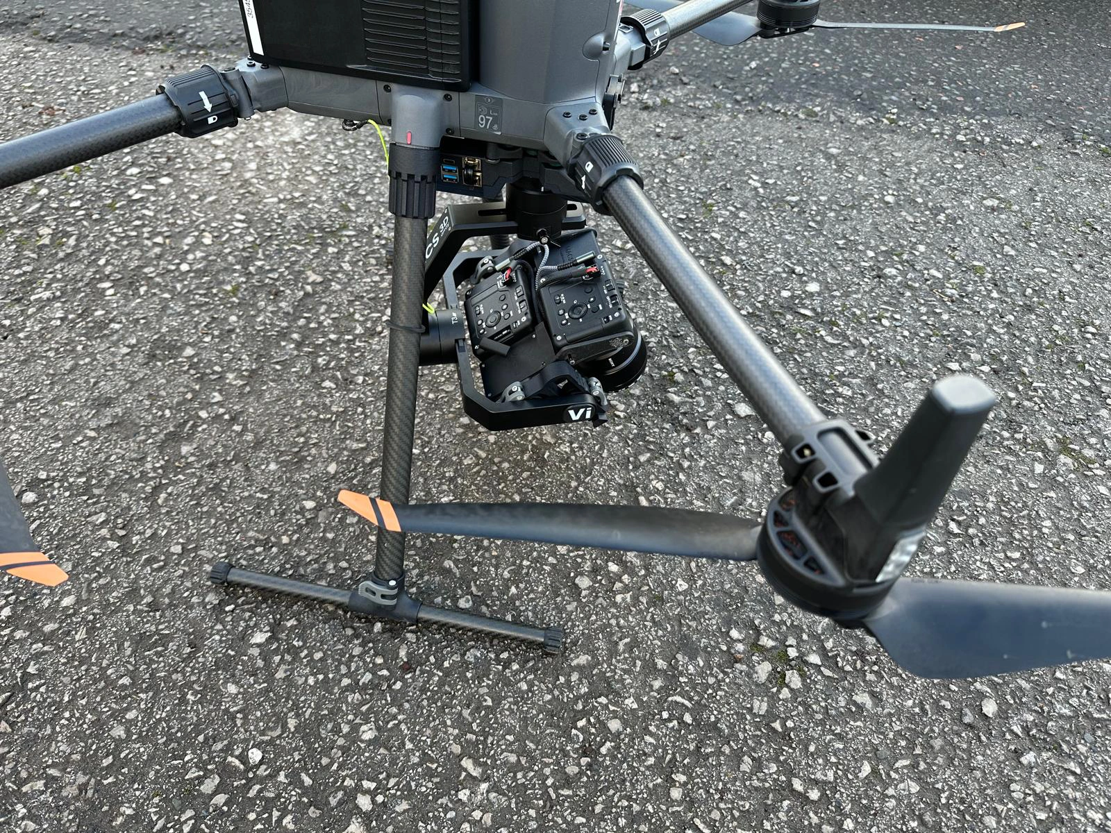
3) Capture
- Choose the right sensor approach for the job: photogrammetry, LiDAR, or a combination.
- Execute a capture plan that supports measurement, not just visuals.
- Capture supporting evidence that helps with validation and reporting.
4) Processing pipeline
We use photogrammetry and LiDAR where appropriate, processing them into 3D models and point cloud outputs that can support CAD, Revit and BIM workflows.
5) QA and validation
This is where confidence is earned:
- Check points and residuals
- Repeat measurements on key features
- Clear reporting on what was checked, how, and what the results mean
6) Delivery and integration
The final deliverable is not “a model”. It is a dataset that slots into your workflow without friction, plus enough documentation to make it usable and auditable.
Photogrammetry vs LiDAR for Engineering-Grade Deliverables
Both methods have their place. Photogrammetry delivers excellent results when you manage lighting, capture strong texture, and maintain tight control of the workflow. LiDAR handles complex structural elements and challenging environments where imagery falls short, and it often delivers high geometric fidelity. Choose the method based on the asset and the requirement, not on habit.
What you can receive
Engineers and BIM teams typically want outputs that are measurable, shareable, and compatible:
- Point clouds for measurement and modelling
- Textured meshes and 3D models for visual review and clash context
- Digital twins and “snapshot in time” datasets for repeat inspection and change detection
- CAD-ready outputs and Revit/BIM-friendly files to plug straight into design and FM workflows
Common point cloud formats we deliver include ASTM E57 (.e57), Autodesk ReCap (.rcp) and ASPRS LAS (.las), and we can provide other formats depending on what your team or client requires.
We also put a lot of effort into making outputs easy to interpret. For example, on inspection work, we provide colour-coded sectioned overviews so your team can immediately see where each image sits on the structure or site.
High Precision at Scale for Multi-Site Programmes
Rail and telecom portfolios rarely cover one site. Programming success or failure depends on consistency across dozens or hundreds of assets.
Our strategically located pilots enable UK-wide multi-site delivery with faster mobility and precision.
Portfolio clients can organise photographs, reports, 3D models, and datasets in safe, familiar web distribution portals. Password-protected, non-indexed portals simplify multi-job access for telecom mast work.
When implementing a national programme, ask about volume efficiencies and volume-based pricing. Standardising scope and outputs across the portfolio can minimise cost per asset in multi-site work operating models.
Mini-scenario 1: Rail asset data without wasted site time
A common challenge is needing measurable geometry and condition evidence within tight access windows. A high-precision dataset can support:
- off-site review by engineering teams,
- measurement of features relevant to design or maintenance planning
- Reduced time on track or at height by limiting follow-up visits
The key is scoping the survey to match rail constraints and planning the capture so that occlusions and access limitations do not undermine measurement confidence. When done properly, you get a dataset your team can interrogate repeatedly, rather than a one-off set of photos.
Mini-scenario 2: Telecoms masts that do not require repeated climbs
Telecoms assets change: antenna swaps, bracket modifications, cable runs, and incremental alignment issues. Drone surveys can provide imagery, 3D modelling, geo-referencing, and specialist analysis, depending on requirements.
From the captured dataset, engineers can take measurements such as height, antenna azimuth angle, downtilt and plumb, helping to prioritise engineer workflow and reduce network downtime planning.
The forward-looking value is repeatability: capture the same mast on a programme schedule, and you build a measurable change history that supports proactive maintenance rather than reactive call-outs.
When a Drone is not the Right Tool
Trust comes from knowing the limits. A drone-based survey may not be the best approach when:
- The requirement is internal and cannot be captured via an external line of sight.
- The asset has severe occlusion, and you cannot safely obtain sufficient views.
- The environment creates poor GNSS conditions, and there is no agreed-upon control plan to mitigate them.
- The project requires physical contact measurement or intrusive testing.
- Safety and permission constraints prevent achieving the required standoff distance or capture geometry.
In these cases, a hybrid approach (drone plus traditional survey methods on critical features) is often the most sensible route.
How to Specify a High-Precision Drone Survey
Use this checklist to get a clean scope and avoid rework:
- Asset type and constraints
- rail environment, telecoms mast type (monopole, lattice), access windows, safety restrictions
- Required outputs
- point cloud, mesh, 3D model, digital twin, CAD, Revit, BIM deliverables
- File formats
- E57, RCP, LAS, plus any client-specific formats
- Coordinate system requirements
- local grid vs national system, and any transformation requirements
- Tolerance and accuracy requirements
- What must be accurate, and where (local features vs overall model)
- Validation evidence
- What QA outputs do you want reported (checkpoints, residuals, repeat measurements)?
- Programme scale
- number of sites, expected cadence, and timescales for a multi-site portfolio
- Deliverable usability
- Who will use the data (design, BIM, maintenance) and what tools will they use?
FAQ
Can you really deliver sub-1 mm?
Yes, in suitable scenarios with the right survey design, control, standoff distance, and validation plan. It should be scoped as a specification-driven deliverable, not assumed as the default.
How do you prove the accuracy?
Through a defined QA approach: checkpoints, residual reporting, repeat measurements on key features, and documentation that ties the method to the requirement.
Which format do you deliver in?
Common point cloud formats include E57, RCP and LAS, and we can provide other formats depending on your workflow.
How do you support Revit and BIM workflows?
We deliver outputs that support CAD, Revit and BIM use, including 3D models and survey deliverables designed to integrate into those environments.
Do you use photogrammetry or LiDAR?
Both, depending on the asset and the requirement. Photogrammetry and LiDAR each have strengths, and the right choice depends on geometry, visibility, environment, and the outputs you need.
What do you need from us to scope properly?
Asset type, constraints, required outputs and formats, coordinate system, tolerance requirements, and how you want validation evidence reported.
Can you deliver across a national portfolio?
Yes. We operate UK-wide and support multi-site and large portfolio programmes with consistent reporting and secure data access.
How do you keep multi-site deliverables organised?
For portfolio clients, we provide branded delivery portals so your team can access images, reports, models and datasets in a secure online environment.
Are you compliant with complex operating environments?
We operate under CAA Operational Authorisation and maintain relevant accreditations and compliance practices. We also hold accreditations from SafeContractor, ConstructionLine Gold, SSIP and Cyber Essentials, amongst others.
Next step: Scope it like an Engineering Project
If you are planning a rail or telecoms mast programme and accuracy is non-negotiable, start with a short technical scoping call. Tell us the asset type, the number of sites, the outputs you need (point clouds, 3D models, CAD, Revit, BIM), your preferred formats, and the tolerances that matter. We will design the survey method around the requirements and agree on how validation will be evidenced.
Email info@dronesitesurveys.co.uk, call 0345 017 5592, or use the contact form on the Contact page.


