
Choosing an appropriate surveying method has a big effect on the accuracy, timeliness, and budget of projects in building, engineering, and property management. People have relied on traditional measuring methods for a long time, but drone-based measured surveys are quickly changing the field. Being aware of the differences between these two measuring methods will help you make smart choices for your needs.
Understanding Traditional Surveying Techniques
Traditional surveying employs proven techniques such as manual measurement tools, GPS systems, theodolites, and laser scanning technology. Surveyors methodically record data points either physically or with computerised gear and then turn them into maps or 3D models. This method is widely used in the UK construction and land management industries, where it is regarded as precise and reliable.
Pros:
- Highly accurate for precise boundary and structural measurements.
- Trusted, proven methodologies.
- Effective in densely vegetated or obscured areas.
Cons:
- Time-consuming and labour-intensive.
- Limited by terrain accessibility.
- Higher costs due to extensive manual labour.
Exploring Drone Measured Surveys
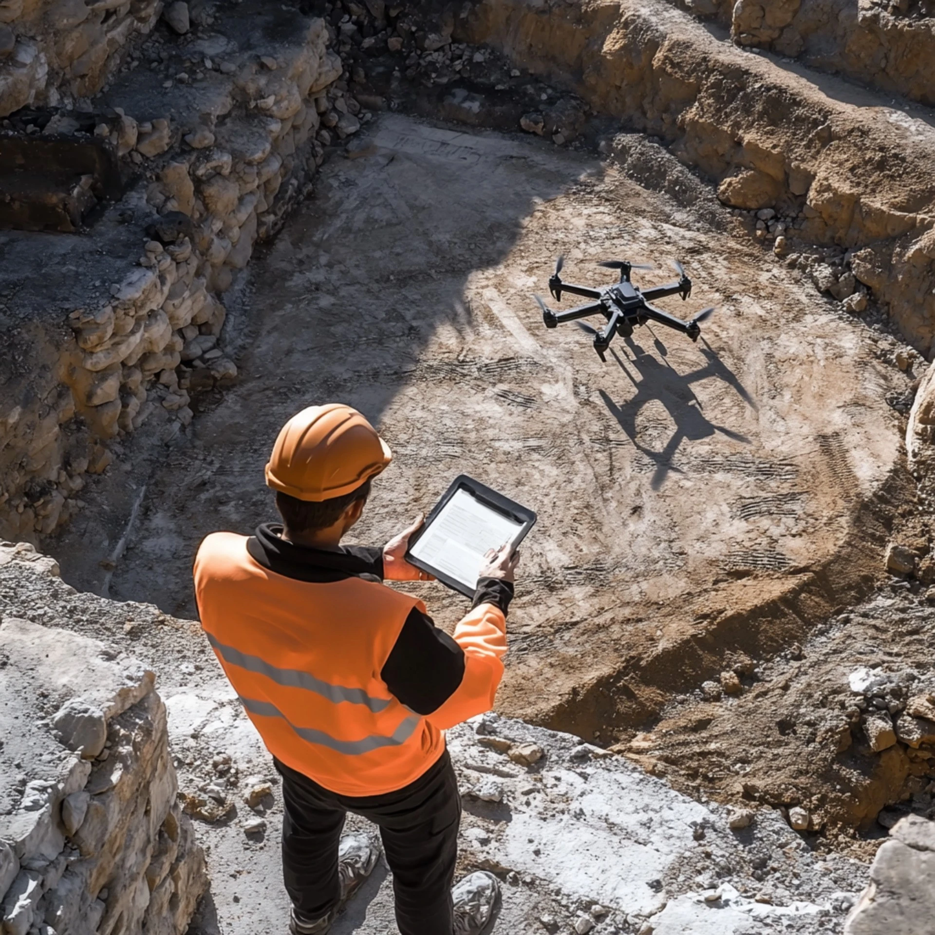
Drone measured surveys, also known as aerial surveys, use unmanned aerial vehicles (UAVs) that are outfitted with LiDAR, thermal imaging, sophisticated cameras, and other remote sensing tools. Businesses that specialise in quickly and precisely gathering high-resolution airborne data, like Drone Site Surveys, greatly increase productivity on a range of survey tasks.
Advantages:
- Significantly faster data collection compared to traditional methods.
- Enhanced safety by accessing hazardous or inaccessible locations.
- Cost-effective for large-scale and frequent surveying projects.
- Precise and detailed 3D modelling capabilities.
Limitations:
- Sensitive to weather conditions, particularly high winds or heavy rain.
- Restricted by flight regulations and controlled airspace limitations.
- Limited accuracy in heavily vegetated or obstructed terrains without supplementary ground control points.
Comparing Accuracy and Efficiency
When it comes to surveys, accuracy is crucial. Conventional techniques frequently yield millimeter-level accuracy for measurement jobs. Drone surveys, however, can also attain high precision—usually within a few centimetres, especially when done properly. Drone-measured surveys are especially useful in bigger, more complicated terrains where conventional techniques could be time-consuming or difficult.
The advantage is that drones are more efficient. Drone technology can frequently map a site in a matter of hours, providing for a quicker project turnaround and fewer operational delays than traditional surveying methods that take days or even weeks.
Practical Applications in UK Industries
Construction and Infrastructure:
In the UK building industry, measured surveys done by drones quickly provide site analysis, progress tracking, and quality assurance. This cuts project timelines by a large amount and improves site management.
Agriculture and Environmental Monitoring:
Drones make it possible to quickly and regularly check over farming land to find places where crops are struggling or where the environment is changing, which is difficult to do with traditional surveys.
Heritage and Conservation:
Projects aimed at preserving the UK’s historic structures and places have benefitted substantially from the use of drones, which provide thorough documentation without the dangers of human surveyors.
Cost Considerations:
Budget limits often affect the choice of survey method. Traditional surveying becomes more costly as the location becomes more complex and requires more time. However, drone surveys offer cost benefits that can be scaled up, which is especially useful for large or regularly inspected projects. For example, Drone Site Surveys regularly offers data solutions that are specifically designed to meet the needs of a wide range of industries, with a focus on being cost-effective and flexible.
Choosing the Right Method for Your Project
Whether to use traditional surveying or measured surveys by drone depends on the project’s needs. Using traditional methods is often best for smaller, more detailed studies or for places in cities where there are many obstacles. In contrast, drone surveys are very useful in big areas that are difficult to reach or dangerous.
Drone measured surveys are great for a wide range of tasks, such as evaluating infrastructure, mapping large areas of farmland, or keeping an eye on a building site. The results are quick, accurate, and easy to use. On the other hand, traditional surveys are still the best way to do projects that need many specifics, like archaeological digs or planning for buildings in the city centre.
Using multiple methods often yields the best results. Drone scans can quickly gather information about a large area of land, while traditional surveying methods can confirm important points that need to be very accurate.
Future Trends in Surveying
The capacity to conduct surveys is being enhanced by tech-driven drone advancements. The surveying industry in the UK could be utterly transformed by the continuous advancements in drone sensors, software, and regulatory frameworks, which are making drone measured surveys more precise, less expensive, and more generally liked.
Adapting to Technological Evolution
Both traditional surveying and measured surveys by drone have their benefits, and they work best when used together rather than against each other. The specific needs of the project will determine which way is best. Professionals stay competitive, and projects get the best results quickly and cheaply by keeping up with new technologies like drone surveys.


