
Building safety information can be technical and abstract, and it is difficult for residents to visualise it. Positive imagery helps close that gap.
Capturing the right visual evidence early can significantly simplify the management of various housing problems. Teams cannot solve every issue from the air, and drones should not lead every inspection, but a properly planned survey can answer many external building questions faster and more safely.
For resident engagement teams and building safety managers, the real value is not simply sending a drone up for a few photographs. The value is that it turns building issues easier to explain into clear outputs: condition imagery, thermal insight where appropriate, sectioned overviews, measurements, reports, and records that help people decide what to do next.
How Tenant Engagement Building Safety Drone Surveys Can Clarify Issues
Tenant engagement and building safety drone surveys can assist housing organisations in translating complicated exterior building issues into actionable visual information. They are especially beneficial if a fault is difficult to see from the ground or where typical access would require scaffolding, ladders, or mobile platforms.
A drone survey can help you see roof coverings, gutters, chimneys, parapets, facades, flashings, cladding details, drainage pathways, and visible indicators of deterioration. It might also assist in documenting the conditions before and after repair work is performed.
Residents can use this type of data to comprehend the necessity of additional inspections, the need for access, or the prioritisation of repair work. It can also assist teams in avoiding providing ambiguous explanations that cause confusion or anxiety.
Drone site surveys frequently assist clients by gathering visual recordings that allow people to better comprehend the condition of high-level locations. When used effectively, the visualisation becomes part of a larger building safety conversation rather than a substitute for a professional opinion.
Safer Access to High-Level Building Areas
Building safety work depends on reliable evidence. Teams need a clear record of the inspected areas, the visible issues, the conditions found and the areas that need further attention.
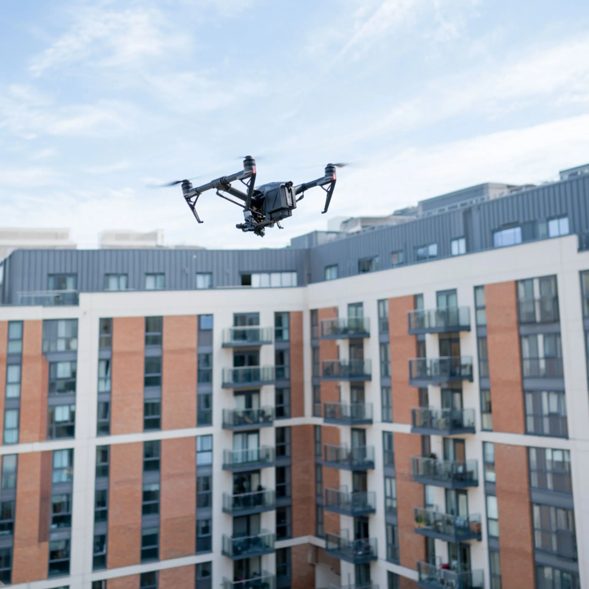
High-level building elements are often the hardest to inspect safely. Drones can reduce the need for people to work at height while still capturing detailed imagery that technical teams can review.
Accountable individuals, resident engagement teams and project leads gain a clearer shared record, rather than just a set of impressive aerial photos.
Where a Drone Survey Can Help
Drone surveys should begin with the client’s inquiry. Has the roof leaked? Gutters failing? Does the facade look weathered? Any specific detail causing heat loss? Should a contractor have more access to information before pricing?
Once the subject is defined, the survey may focus on practical outputs rather than drone novelty. For tenant engagement and building safety drone assessments, the approach helps communicate technical information without simplifying it.
Drone Site Surveys performs roof, building, thermal, pre-solar, point cloud, progress monitoring, and housing deterioration assessments. Instead of employing the same procedure for every site, the method can be tailored to the decision.
- Facades and elevations: Capture visual evidence of cracking, staining, spalling, failed sealants, fixings or other visible concerns.
- Roofs and high-level details: Inspect hard-to-access areas that may need remediation, planned works or further intrusive checks.
- Before and after records: Create a useful record before work begins and after contractors have completed key stages.
- Resident communication: Use clear imagery to explain what has been inspected and what will happen next.
What Useful Outputs Look Like
This stage is where drone work either becomes useful or becomes another folder of nice images. Housing teams require information that they can review, share, and act upon.
Drone survey teams can deliver images, data and reports through a secure online portal, using sectioned overviews to help users locate defects across a building or site more easily.
- High-resolution imagery for technical review
- A record of high-level areas without unnecessary working-at-height exposure
- Visual evidence to support remediation scopes and resident updates
- Sectioned building overviews to make defects easier to locate
- A repeatable record for future comparison
Practical Considerations Before Commissioning A Survey
Before commissioning a drone survey, housing teams should consider its purpose, the site conditions and the people who will use the outputs.
A comprehensive brief should encompass the building areas for inspection, known concerns, access limitations, required deliverables, and any resident communication needs. It should also consider privacy, site safety, weather, permissions and operational planning.
The survey provider should work within relevant aviation rules and plan their work around safe flight conditions. They should also understand that residential buildings require careful communication and respect for privacy.
The best results come from a clear question and a clear output. Planning the survey around the decision at hand enhances the usefulness of the final information.
Final Thought
Drone surveys can play an important role in building safety communication, especially when residents need to understand issues that are difficult to see from the ground. They provide visual evidence, support safer early inspections and help teams make more informed decisions.
They should not be treated as a complete answer to every building concern. Instead, they work best as part of a wider inspection and engagement process. When they are used well, they help housing teams explain problems clearly, plan further action, and maintain better records.
For resident engagement teams and building safety managers, the real benefit is not the drone itself. It is the ability to turn hard-to-access building information into clear, useful evidence that supports better decisions and more meaningful conversations with tenants.