
Local authorities housing teams are under growing pressure to maintain safer, warmer, and better-quality homes while working with limited budgets. Repairs, planned maintenance, disrepair claims, and regeneration programmes all need evidence that is clear, practical, and easy to share.
This is where local authority drone surveys for housing can support better decision-making. A drone survey will not solve every building problem, and it should not replace the judgment of a competent surveyor. However, when used properly, it can help housing, asset, and regeneration teams understand visible external conditions before committing to higher access costs or wider repair programs.
The value is not simply in taking aerial photographs. The value comes from capturing the right evidence, presenting it clearly and using it to decide what should happen next.
Why Housing Teams Need Clearer External Evidence
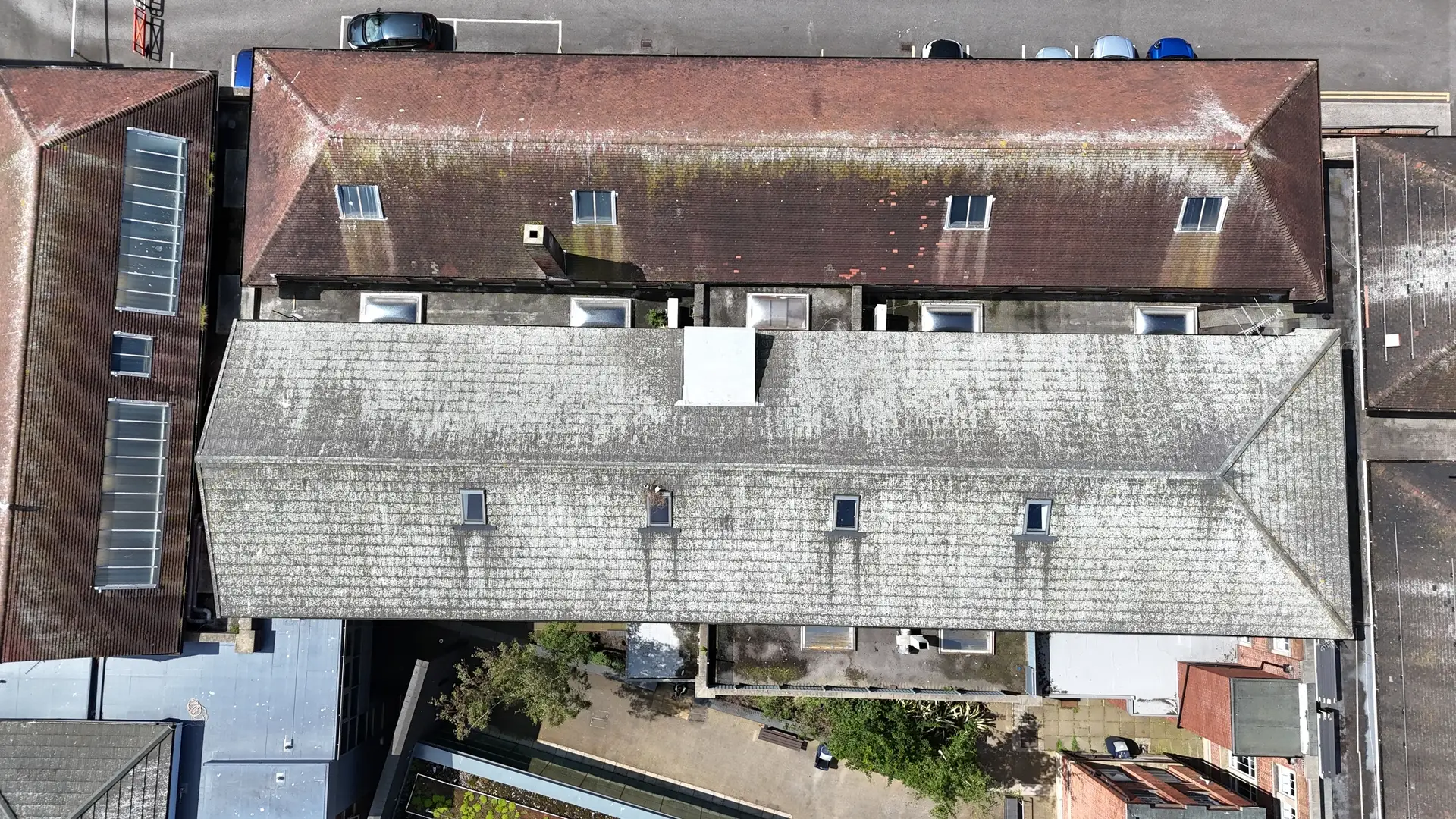
Identifying housing issues early makes them easier to manage. A slipped roof covering, a blocked gutter, damaged flashing, a weathered elevation, a chimney defect, or a visible heat loss pattern can all affect how a repair is prioritised.
Traditional inspections are crucial when close contact, intrusive investigation, or physical testing is necessary. However, a safe external viewpoint can often answer many early-stage questions.
For council housing teams, these techniques can reduce uncertainty. Instead of relying only on ground-level observations, resident photographs or limited access notes, teams can build accurate and up-to-date evidence about the condition of homes review clearer imagery of roofs, elevations, gutters, chimneys, and surrounding site conditions.
This helps teams move from assumption to evidence.
Where Drone Surveys Add Value for Local Authorities
A useful drone survey starts with a practical question. For example:
- Is water likely to be entering through the roof?
- Are gutters blocked, damaged or overflowing?
- Do elevations show visible signs of weathering or movement?
- Are access restrictions likely to affect contractor pricing?
- Is a closer inspection or specialist follow-up needed?
When the question is clear, the survey can focus on useful outputs rather than unnecessary imagery.
Drone surveys may support a range of local authority housing and asset management tasks, including roof inspections, building condition reviews, thermal surveys where suitable, pre-solar assessments, progress monitoring, housing disrepair evidence and planned maintenance records.
The strongest results usually come when the survey scope matches the decision the council needs to make.
- Portfolio triage: Identify roofs, elevations and estates that appear to need more urgent attention.
- Repair evidence: Capture imagery that supports contractor briefs and internal decision-making.
- Regeneration context: Use aerial views to understand site layout, access and estate condition before larger programmes begin.
- Repeatable records: Revisit assets over time to track visible change and support planned maintenance.
What Useful Outputs Look Like
A drone survey should not leave a housing team with an unstructured folder of images. The outputs should help people understand what they are looking at, where it relates to the building and why it matters.
Useful reporting may include:
- Labelled roof and elevation imagery
- Annotated visible defects
- Site overviews and access context
- Thermal insight where appropriate
- Measurements or references were suitable
- We maintain clear records that internal teams and contractors can share.
These outputs matter because housing decisions often involve several people. Repairs managers, asset managers, compliance teams, regeneration officers, contractors and resident liaison staff may all need to understand the same issue.
Good reporting makes the evidence easier to use.
How Drone Surveys Support Local Budget Decisions
Budget pressure makes prioritisation essential. Local authorities cannot treat every visible defect as equal, and they cannot always justify costly access before understanding the likely scale of the issue.
Drone survey evidence can help teams decide where to send the next pound. It can support early triage, reduce avoidable uncertainty and highlight assets that need closer review.
For example, a housing team may receive several roof-related complaints across an estate. A structured aerial inspection can help show whether the issue appears isolated, repeated across similar properties or connected to a wider planned maintenance concern.
This does not remove the need for professional judgement. It gives decision-makers better information before they act.
When a Drone Survey Is Not Enough
Responsible use is important. Some issues still require hands-on testing, intrusive inspections, scaffold access, or a specialist building surveyor. A drone cannot lift roofing coverings, test material strength, confirm hidden decay, or diagnose every defect.
Weather, site layout, resident privacy, access restrictions and permissions can also affect what’s possible. Each project should be planned with safety, data protection and site context in mind.
This balanced approach is important for trust. Drone evidence is most useful when it supports better decisions, rather than claiming to replace every other inspection method.
Building a Smarter Inspection Workflow
Local authority teams usually get the best value when drone surveys sit within a wider inspection workflow.
That workflow may begin with a repair complaint, stock condition concern, regeneration review, planned maintenance programme or disrepair case. The drone survey then captures evidence linked to the main question. Findings can help decide whether the next step is contractor pricing, surveyor attendance, resident communication, capital planning or further investigation.
This approach helps reduce blind spots. A repair manager can safely view a gutter that is otherwise inaccessible from the ground. An asset manager can check the visible roof condition before planning future works. A compliance lead can keep a clearer record of what was visible on the inspection date.
Final Thoughts
The drone is only the tool. The real value lies in asking the right question, capturing useful evidence and presenting it in a way that supports action.
For local authority housing, asset and regeneration teams, aerial surveys can help make constrained budgets work harder. Used carefully, they can improve visibility, strengthen repair records and support smarter prioritisation across council homes and public assets.
Better evidence does not remove budget pressure, but it can help teams make clearer, fairer and more confident decisions.