
Drone-based measured surveys have become very popular in many areas of the UK in the past few years. The use of aerial surveying has grown considerably as businesses look for…

Drone-based measured surveys have become very popular in many areas of the UK in the past few years. The use of aerial surveying has grown considerably as businesses look for…
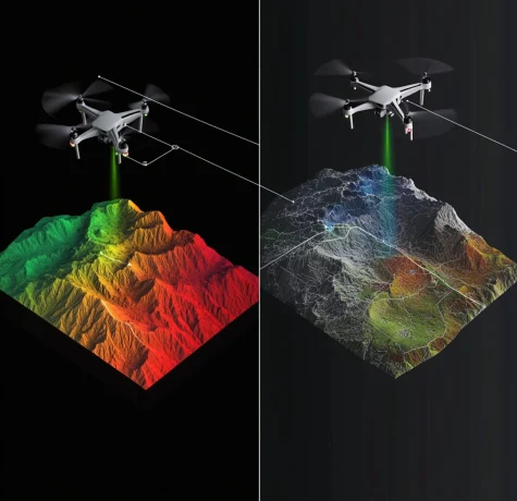
In aerial surveying, professionals often compare photogrammetry with LiDAR (Light Detection and Ranging). Both methods can produce accurate and reliable data, but how do they differ for external envelope building…

Choosing an appropriate surveying method has a big effect on the accuracy, timeliness, and budget of projects in building, engineering, and property management. People have relied on traditional measuring methods…
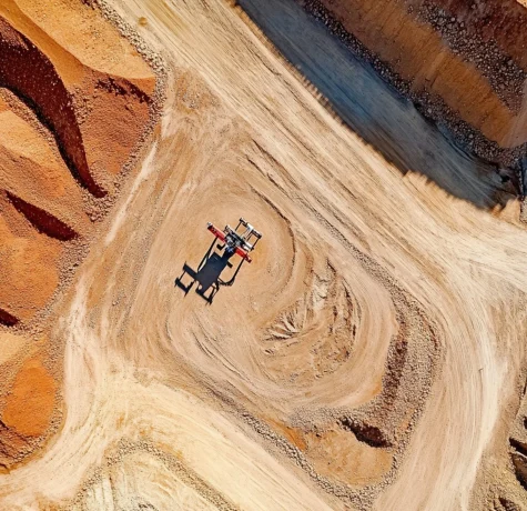
In fields like mining, construction, and logistics, where accurate volume calculations affect cost management and efficiency, stockpile measuring is very important. That being said, which is better: the old-fashioned way…

In the fields of architecture, construction, and property management, measured surveys are extremely important because they provide precise depictions of the spaces that are already in existence. Experts can create…

Drone technology has changed many fields in recent years and stockpile measurement is no exception. Industries such as mining, construction, and agriculture rely on accurate volumetric surveys to optimise operations,…