
Asset management now depends on structured, reliable evidence, and drone survey outputs can play an important role in that process.
For housing providers, estate managers, facilities teams and infrastructure owners, clear visual records can make external building issues easier to understand, compare and act on.
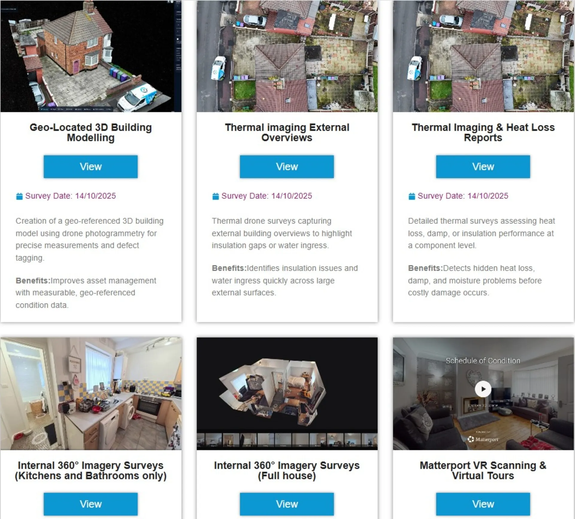
A well-planned drone survey does more than capture photographs. It can create condition imagery; thermal insight where suitable; sectioned overviews; measurements; reports; point cloud data; and digital records that support better decisions.
As AI becomes more common in inspection workflows, high-quality drone data can help teams identify patterns, compare site conditions over time and plan maintenance with greater confidence. However, this only works when the source information is accurate, consistent and clearly organised.
Why Drone Data Matters in Modern Asset Management
Good asset management depends on good information. Teams need to understand the condition of an asset, where risks are developing, and which areas require closer attention. Without clear evidence, repairs can become reactive, budgets can be harder to justify, and small defects may become larger problems.
Drone survey outputs help reduce those blind spots. They give decision-makers a clearer view of areas that may be difficult, costly or unsafe to inspect from the ground. A repairs manager can see a blocked gutter. An asset manager can review the roof condition before planning a programme. A compliance lead can keep a record of what was visible at the time of inspection.
The drone does not replace professional judgment. It improves the quality of evidence available for surveyors, engineers, contractors, and asset teams.
From Aerial Images to Asset Intelligence
A good drone survey starts with the question the client needs to answer. Is there a roof leak, a failing gutter, a weathered facade, a heat-loss issue, or an access problem? Once the aim is clear, the survey can focus on useful outputs rather than simple image capture.
These may include high-resolution imagery, annotated reports, thermal files, measured drawings, orthomosaic maps, 3D models or point clouds. Each output supports a different decision, from visible condition checks to scale, access and location planning.
Drone Site Surveys works across roof inspections, building inspections, thermal surveys, pre-solar surveys, progress monitoring and housing disrepair investigations, with the method matched to the asset and risk.
- Data structure: Agree on how buildings, blocks, roofs, elevations and defect areas will be named and organised.
- Visual context: Use sectioned overviews so individual images make sense when reviewed away from the site.
- Measured outputs: Where needed, combine imagery with photogrammetry, point clouds, mapping or measurements.
- Repeatability: Use consistent capture methods so future inspections can be compared with earlier records.
Why Structure Matters as Much as Capture
Drone survey data becomes more valuable when it is easy to find, compare, share and revisit. Otherwise, it risks becoming another folder of images that nobody uses after the first week.
For asset managers, the useful output is a decision-ready record. The record should show what the team inspected, where they found the issue, what the imagery reveals and what they should consider next.
Clear structure helps achieve this. Buildings, blocks, roofs, elevations and defect areas should be named consistently. Sectioned overviews can help individual images make sense when reviewed away from the site. Measured outputs, mapping and point clouds can be added where the project needs more detail.
Repeatability also matters. If the same site is inspected again in six months or a year, teams need to compare new information with earlier records. Consistent capture methods make that comparison easier and more reliable.
Where AI Fits Into Drone Survey Outputs
AI can support asset management by helping teams process large volumes of visual data. It may help identify patterns, compare images over time or highlight areas that need closer review. For example, AI tools can support the detection of visible changes such as staining, surface deterioration, vegetation growth, ponding water or damaged materials.
However, AI is only as useful as the data it receives. Poor lighting, blurred images, inconsistent angles and unclear file naming can limit the value of automated analysis. Clean, well-organised drone outputs create a stronger foundation for AI-assisted review.
Human oversight remains essential. AI can help sort, flag and compare information, but a qualified person still needs to interpret the findings in context. Weather, building age, materials, previous repairs and site conditions all affect what the data means.
Connecting Survey Outputs With Digital Systems
Many organisations now manage property and infrastructure through digital systems such as asset registers, facilities management platforms and building information models. Drone survey outputs can support these systems when the information is prepared in the right format.
A report can provide evidence for a condition rating. An orthomosaic can help locate defects across a large roof. A 3D model can give teams a clearer view of complex structures. Thermal images can support further investigation into heat loss or moisture-related concerns where appropriate.
The best results come when the final use is considered before the survey begins. If the data needs to support an asset register, maintenance plan, investment case or compliance record, the capture method and reporting format should reflect that from the start.
What Useful Drone Outputs Should Include
This is where drone work either becomes useful or becomes another folder of images. Housing teams, asset managers and maintenance planners need information they can review, share and act on.
Teams can access imagery, data and reports through a secure online portal, while sectioned overviews help them locate defects on a building or site more easily.
Useful outputs may include:
- Organised imagery and reports that teams can navigate
- Data that supports asset decisions rather than one-off viewing
- Point clouds, 3D models or measurements where the project needs them
- A clearer evidence base for maintenance, investment and compliance planning
- Records that can be shared securely with stakeholders
The Practical Benefit for Asset Teams
The main benefit is clarity. Better visual evidence helps teams target follow-up work, brief contractors more accurately and plan maintenance with more confidence.
There may still be a need for hands-on testing, intrusive inspection or specialist review. A drone survey should not pretend to replace every method. Instead, it helps make the next step better informed.
Final Thoughts
Drone survey outputs now sit at an important point between asset management, AI and data strategy. They help organisations capture safer visual evidence, build clearer records and make better decisions about buildings, estates and infrastructure.
The drone is only one part of the process. The real value comes from a workflow that captures the right information, presents it clearly and keeps it useful long after the survey has finished.