


Highway & public realm surveys
Aerial mapping, condition imagery and topographical data for highways, verges, structures and public spaces, captured by drone with less time on the network.
Available Files: Orthomosaics, Topo & CAD, 4K Imagery & 3D Models
Ortho
Measurable Mapping
RTK
Survey-Grade Positioning
4K
Condition Imagery
Less
Time on the Network
Drone Highway & Public Realm Surveys
Surveying roads and public spaces from the ground means time on the network, traffic management and risk to survey teams. A drone survey captures large areas from above in a fraction of the time.
We produce orthomosaics (accurate, measurable aerial maps), topographical surveys and CAD drawings, and close-up condition imagery of verges, embankments, retaining walls and highway structures.
The data supports scheme design, maintenance planning and public realm projects, and gives everyone a clear, dated record of the site.
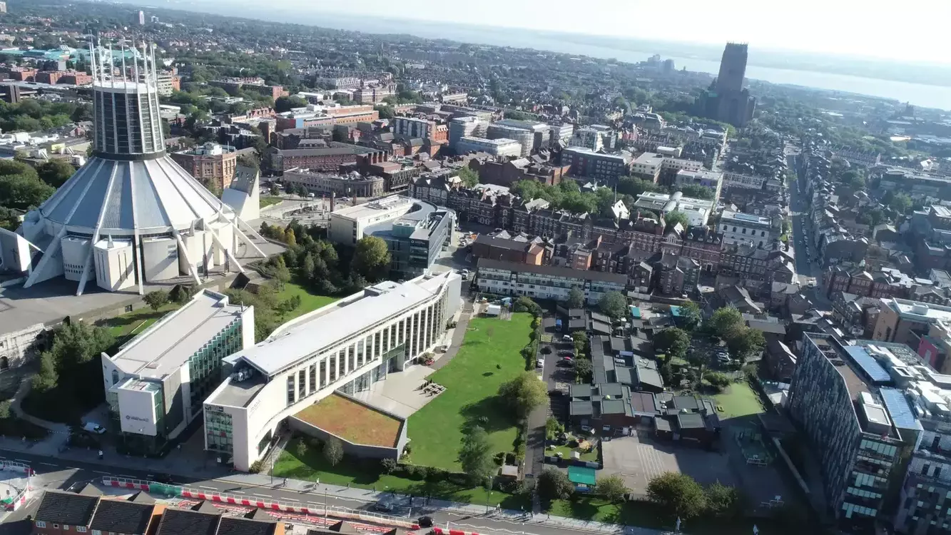
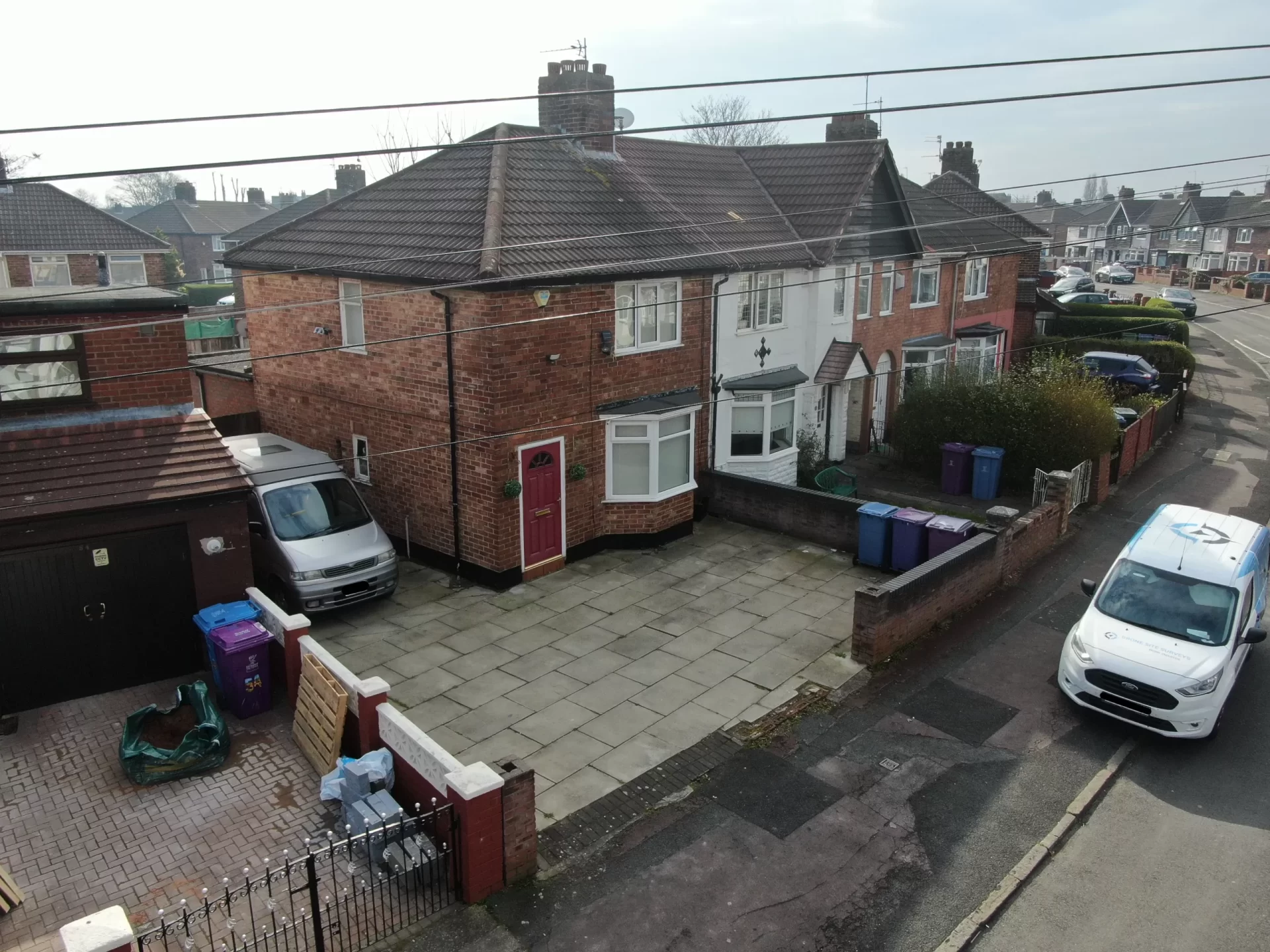
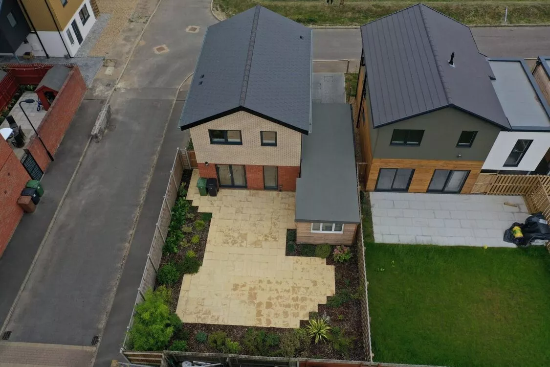
Example Image Quality
Click each image to view example image quality
What Your Highway Survey Can Include
Choose mapping, topographical data or condition imagery. We can combine them in one survey.
| Deliverable | What it is | Included |
|---|---|---|
| Orthomosaic | An accurate, measurable aerial map of the site. | Standard |
| Condition imagery | Close-up 4K imagery of verges, walls and structures. | Standard |
| Online portal | View, measure and share the data online. | Standard |
| Topographical survey | Levels, features and boundaries in CAD. | Optional |
| 3D model | A 3D model of the site and its surroundings. | Optional |
| Point cloud | Survey data in LAS, LAZ or E57. | Optional |
| Repeat surveys | Track change before, during and after works. | Optional |
Flights near roads are planned in advance. Where needed, we work with your traffic management arrangements.
At a Glance
Capture
RTK drone + GCPs
Flight planning
Agreed in advance
Pilot network
Nationwide
Topo & CAD
Available
Scaffold needed
None
Coverage
Mainland UK
Get a Quote
Send us an address. We will come back the same working day with a price and a scope.
Why Councils Choose Drone Highway Surveys
A drone highway survey gives you more data with less time on the network. Clients benefit from:
Knowing the condition of your whole portfolio lets you mitigate risk, prioritise spending and act on real evidence rather than assumptions.
The result?
Accurate site data and imagery, captured quickly with less disruption to road users.
Orthomosaics
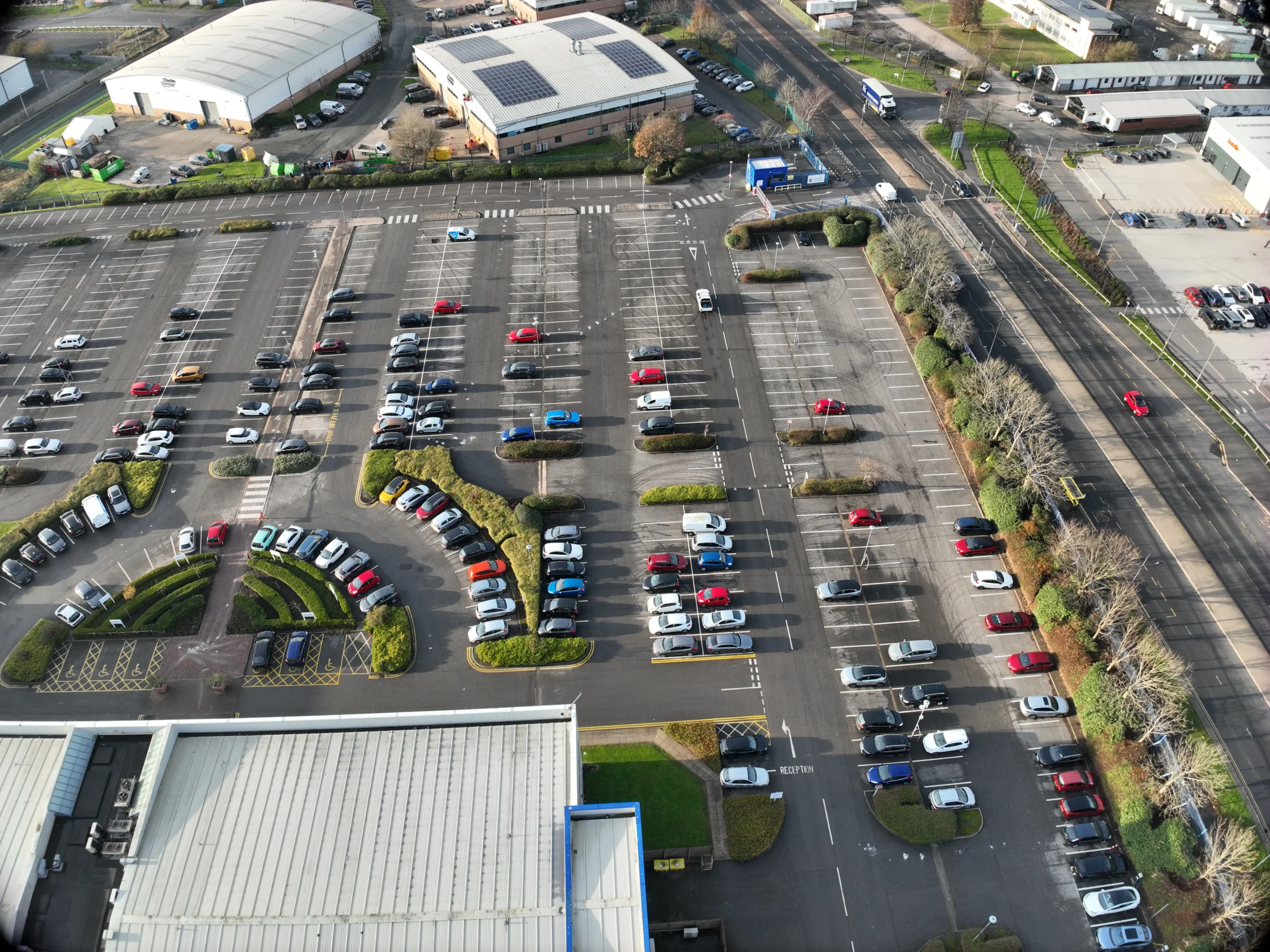
A measurable map of the whole site
An orthomosaic stitches hundreds of overlapping drone images into one accurate, scaled map. You can measure distances and areas, check features and share it with your design team.
Combined with a topographical survey, it gives a complete picture of levels, features and boundaries for highway and public realm schemes.
The whole scheme, mapped from above.
CAA
CAA Operational Authorisation 11363
Fully insured, with £10m public liability and specialist UAV cover
Why drones
Why use drones for highway surveys?
Ground surveys of roads take time, need traffic management and put surveyors near live traffic. A drone captures the site from above in a single visit, with flights planned around road users.
- Fewer people near traffic. The site captured from the air.
- Fast. Large areas mapped in a single visit.
- Accurate. RTK drones checked against ground control.
- Complete. Mapping, topo and condition imagery together.
- Shareable. Data delivered through an online portal.
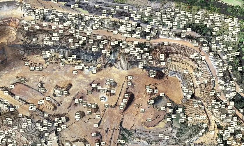
Roads, verges and public spaces mapped from the air.
Who we work with
Highway surveys for councils, engineers and contractors
We work with local authority highways teams, consulting engineers, civil contractors and public realm designers who need accurate site data and imagery.
Our service is suitable for
- ›Local authority highways teams
- ›Consulting engineers
- ›Civil engineering contractors
- ›Public realm designers
- ›Transport planners
- ›Utilities
- ›Developers
- ›Parks and open spaces teams
- ›Drainage engineers
- ›Land and estates teams
For larger programmes, we can survey several sites the same way and deliver all data in one consistent format.
Why choose us
Why choose Drone Site Surveys?
Highway surveys mean working around live traffic, so we plan every flight to keep time on the network to a minimum. Our CAA approved pilots set out ground control and fly the site with an RTK drone, capturing large areas in a single visit with fewer people working near the road.
From that one visit we produce measurable orthomosaics, topographical surveys, CAD drawings and close-up condition imagery of verges, embankments, retaining walls and highway structures. The data is ready for scheme design and condition records, and easy to share with your design team.
Clients choose us for highway and public realm surveys because we offer:




How it works
Our highway survey process
From first enquiry to secure delivery, every survey follows the same six steps, so you always know what happens next and when.
Tell us about the property
Send us the extent of the site and the outputs you need. We’ll plan flights, take-off points and any coordination with traffic management.
Planning and quote
We carry out a desktop assessment of the property and the surrounding airspace, check the survey against current UK drone regulations, and prepare your quote. You receive it by email with no obligation, along with the airspace map for your site and an example delivery so you can see exactly what you’ll be getting.
Booking your date
Once you’re happy with the quote we add your job to the schedule and start monitoring the Met Office forecast. In the meantime we prepare the pre-flight paperwork, including our risk assessment and method statement (RAMS), which we can send over for your records. As soon as we have a clear weather window and pilot availability, we confirm your attendance date. You don’t normally need to be on site.
The survey
Our CAA approved pilots set out ground control and fly the site with an RTK drone, following a planned route.
Processing
The imagery is processed into orthomosaics, topographical data and condition imagery, then delivered through our online portal.
Delivery
We email you a link to our secure online portal, where your imagery, reports and any other agreed outputs are ready to view, download and share with your team or contractors. Alongside the deliverables you’ll find a folder containing the pre-flight paperwork, a copy of the drone airspace map for your site and any other relevant documents, so everything from the survey is in one place.
Request a Quote
Request a highway survey quote
Whether it’s a single junction or a long stretch of road, we can tailor the survey to your scheme.
Send us the location and a brief description of what you need, and we will come back with clear pricing and deliverable options.
Prefer to Speak to Us?
If you’d rather speak to one of the team, that’s no problem. Simply call the number below and one of our team will be more than happy to help.
Get a Quote
The quote form is taking a while to load. Open the simple form, call 0345 017 5592 or email info@dronesitesurveys.co.uk.
In The Know
Frequently Asked
Questions
Answers to the questions we are asked most often about highway surveys. If yours is not covered here, give us a call.
What can a drone highway survey capture?
Orthomosaics, topographical data, 3D models and close-up imagery of verges, embankments, retaining walls and highway structures.
Do you need to close the road?
Usually not. We plan flights and take-off points to keep clear of traffic, and work with your traffic management where it is needed.
How accurate is the mapping?
We use RTK drones checked against ground control points. We’ll confirm the expected accuracy for your site when we quote.
What formats do you supply?
Orthomosaics, CAD drawings (DWG/DXF), point clouds and 3D models, delivered through our online portal.
Can you survey before and after works?
Yes. Repeat surveys using the same method give a clear record of change.
Can you inspect bridges and structures too?
Yes. See our bridge inspections page.